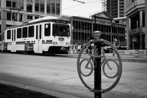
 Thinking of getting into better biking shape? The best way to do so, is to start riding more! If you live in the Salt Lake area, you are a lucky cyclist. Not all cities are nearly as bike-friendly as this wonderful mountain town, so take advantage of the riding possibilities while you live here!
Here are a few of the major bike routes around Salt Lake City:
From BikeSLC.com, and their Salt Lake City Bike Map, and also from bikemap.net
Salt Lake City International Airport
There is a bike path conveniently located at the airport! The path doubles as a jogging path as well, and is only open during certain hours of the year. From February 1st-October 31st, it opens at 5:30 am, and closes at 10:00 pm. November 1st-January 31st, it opens at 7:00 am and closes at 7:00 pm. During normal hours, there are five closed security gates, but they are all unlocked, as the path is open to the public. After hours, or during a security threat, the gates are locked. However, if you need to get access of the airport trail during closed hours, you can apply for a security badge, after a background check and a $15, which will work until your next two birthdays. If you are interested in getting a security badge, call Airport Access Control at 801-575-2204.
The bike and jogging path is well-marked. There are bike racks just south of the Terminal 1 building, where you can house your bike under a metal covered walkway.
CIty Creek Canyon:
Starting from the crossroad at 2nd Ave and Canyon road, there is a shared used path available to bicyclists going north up City Creek Canyon. It is a 6.6 miles route, no vertical climb, and it is paved, specifically for bicycles and races. It is open from 8:30 am to 10:00 pm. This path actually has some strange hours, so be aware: it’s only open from the last Monday in May to the last weekend of September, on odd days. Also biking is not allowed on summer holidays. All of these rules are there because the road is shared by motor vehicles, so when bikes are allowed during those months, cars are not (except maintenance vehicles). However during the rest of the year, there are no restrictions, you could bike every day.
The speed limit up the canyon is 15 mph, and they will give you a ticket–even on your bicycle! Also, the road is narrow, with many curves and blind turns. Stay alert, aware, and on the right side of the road.
Jordan River Trail
About three blocks west of Temple Square, the Jordan River Trail runs north-south all the way through Salt Lake City. You could continue it up to Bountiful or Davis County, or you could continue it down to Sandy or Utah Lake. Along the trail, you could run into a fun park: on the south side of the crossroad at 1700 S and the bike trail is the Raging Waters Water Park, one of the largest water parks in the state. It even has a water slide roller coaster!
Roads Around Temple Square
Lucky for the bicyclists out there, most of the roads surrounding temple square have bike lanes. Running north-south: 600 W, part of 500 W,200 W, and 300 E; running east-west: 300 N, 200 S and 800 S, as well as 2nd Ave, and 3rd Ave, all have bike lanes, encouraging bikers to be active and riding the streets!
There is so much to do in Salt Lake City proper. You have the Capitol Theater, The Salt Palace, The Salt Lake Art Center, Abravenal Hall, the Family History Library, the LDS Conference Center, the Gateway Mall, and the Energy Solutions Arena are all within about a square mile of each other.
Bountiful Loop
If you are looking for a nice ride, there is loop in North Salt Lake. It is 11.9 Miles, and for a newer cyclist, the steep road can be difficult. In the approximate 1-hour trip, there is a vertical climb or 1213 ft. The road is paved, and once you get past the initial climb up Bountiful Blvd, you have made it past the most difficult part.
The loop is east of I-15, if you get off on South Main Street, and continue it North until West 1800 South, go east until the road turns into East 1800 W, turn south onto South 900 east, and you should be right at the starting point of the loop. You travel along South Davis Blvd., down on Bountiful Blvd, then up north-west to South Eaglewood Dr. all the way up until you hit Orchard Dr., continue North back up to East 1800 South and back to where you started. The road is paved, and perfect for bicycling!
Liberty Park
On the west side of 700 E and 900S, Liberty Park is a wonderful little loop, for a leisurely ride. It is 80 acres, with a pond and two islands. It’s a popular circumference for cycling, and it’s a lovely little route.
Take advantage of the very cool city you live in, especially as the weather gets warmer. Use some of these bicycle paths and enjoy the outdoor atmosphere in the heart of the country’s mountains!
Image courtesy of flickr.com.
